[Attribute Mapping]
Attribute Mapping function is described in this page.
In iRIC, grid can have attributes. Attributes can be defined at the following positions. Solver developer can decide the character of the grid attributes: the position and the value type.
Nodes
Cells
Grid attributes can be mapped from geographic data. If multiple geographic data exists in the geographic data folder, the data in the upper side has higher priority.
Grid attribute mapping is executed automatically after the grid is generated. Users can manually execute attribute mapping, after editing geographic data, for example.
[Execute]
Description: Execute grid attribute mapping.
You can execute grid attribute mapping with the following action:
Menu bar: [Grid] (G) –> [Attributes Mapping] (A) –> [Execute] (E)
“Attribute Mapping” dialog (Figure 351) is shown, so check on the grid attribute you want to execute mapping, and click on [OK] button.
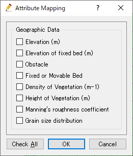
Figure 351 [Attribute Mapping] dialog
[Setting] (S)
Description: Edit the setting about grid attribute mapping
You can edit grid attribute mapping setting with the following action:
Menu bar: [Grid] (G) –> [Attributes Mapping] (A) –> [Setting] (S)
[Grid Attribute Mapping Setting] dialog is shown, so edit setting, and click on [OK] button.

Figure 352 [Grid Attribute Mapping Setting] dialog
About mapping geographic data
In this section, the algorithm to map geographic data to grid attributes is described.
[Point Cloud Data]
[Node attribute]
[Pointset Data] is mapped using TIN, as default. When a triangle that contains the grid node is found, the weighted averaged value that is calculated from the values at triangle nodes are mapped.
[Cell attribute]
[Pointset Data] is mapped using TIN. When a triangle that contains the cell center is found, the weighted averaged value that is calculated from the values at triangle nodes are mapped.
[Cross-Section Data]
[Node attribute]
[Node attribute] values are mapped with the values calculated from the cross section elevation data. The calculation is executed like below:
Cross sections are linked with cubic spline lines. The cubic spline lines links the corresponding points of each cross section, like left bank, right bank, river center line, etc.
Value at grid nodes are calculated from the values defined at cross sections on the spline line, that passes the grid nodes. The value is a weighted average value calculated from the values at upstream side cross section and downstream side cross section.
[Cell attribute]
[Cross-Section Data] does not support mapping to [Cell attribute].
[Raster Data]
[Node attribute]
Find the pixel (quadrangle) that contains the grid node, and map the value defined at the pixel.
[Cell attribute]
Find the pixel (quadrangle) that contains the grid cell center, and map the value defined at the pixel.
[Polygons]
[Node attribute]
When the node is included in the polygon, the value of polygon is mapped.
[Cell attribute]
When the cell center is included in the polygon, the value of polygon is mapped.
Note
Specification changelog
Until iRIC 3.0.3, [Polygon] value was mapped to grid cells when all the nodes of the grid cell are inside the polygon.
[Lines]
[Node attribute]
When line crosses an edge of grid, line data is mapped to the nodes of the edge.
[Cell attribute]
When line crosses a cell, line data is mapped to the cell.