[Google Earth KMZ for street view] (G)
Description: Export Google Earth KMZ file with which we can visualize the water Depth on street view.
To use this function, you have to satisfy the following requirements first:
Open and activate a [2D Post-processing Window]
Draw [Scalar (node)] for calculation result value [Depth].
Setup property for [Scalar (node)] to make [Display Setting] to [Contour Figure], not [Color Fringe] or [Isolines], and check off [Automatic] Check box in [Value range] group box.
Figure 95 shows an example of iRIC GUI after satisfying the requirements.
When you launch [Google Earth KMZ for street view] menu, the dialog in Figure 96 is shown. Please specify the name of file, and select the timesteps you want to export, and click on [OK]. Then, the KMZ file is exported.
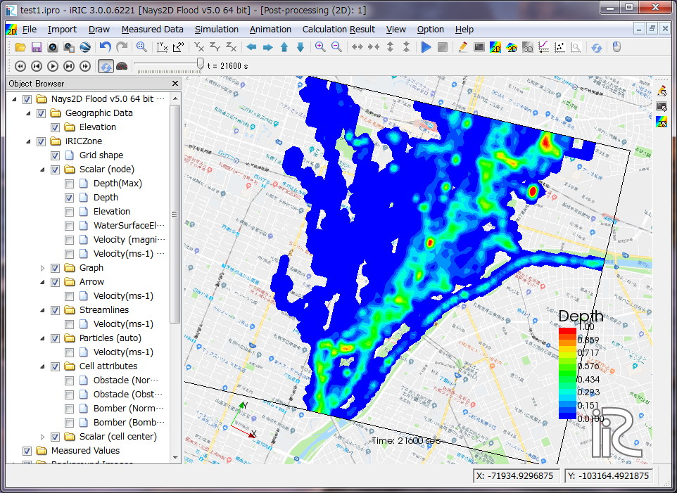
Figure 95 [2D Post-processing window] with [Contour Figure] for depth
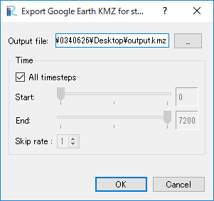
Figure 96 [Google Earth KMZ for street view export] dialog
Figure 97 shows an example of Google Earth after loading the exported KMZ. When you show street view for regions where polygons for depth values exist, the polygons are shown in the street view so that we can easily see that the depth, like in Figure 98.
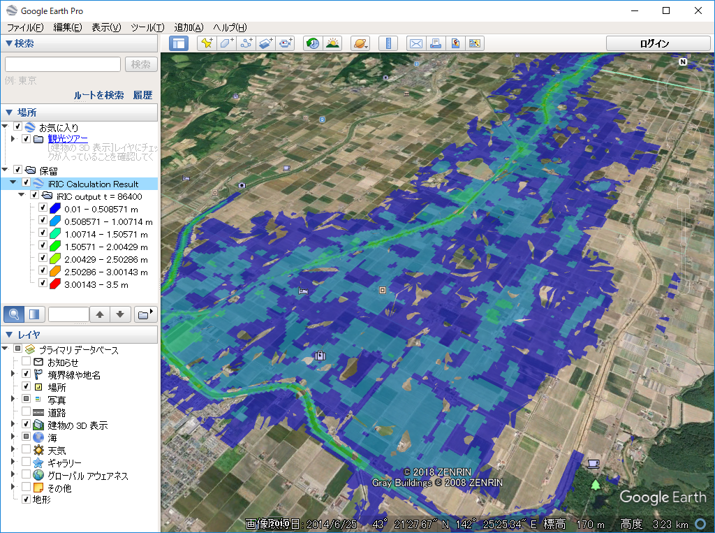
Figure 97 Example of [Google Earth] after loading a KMZ file
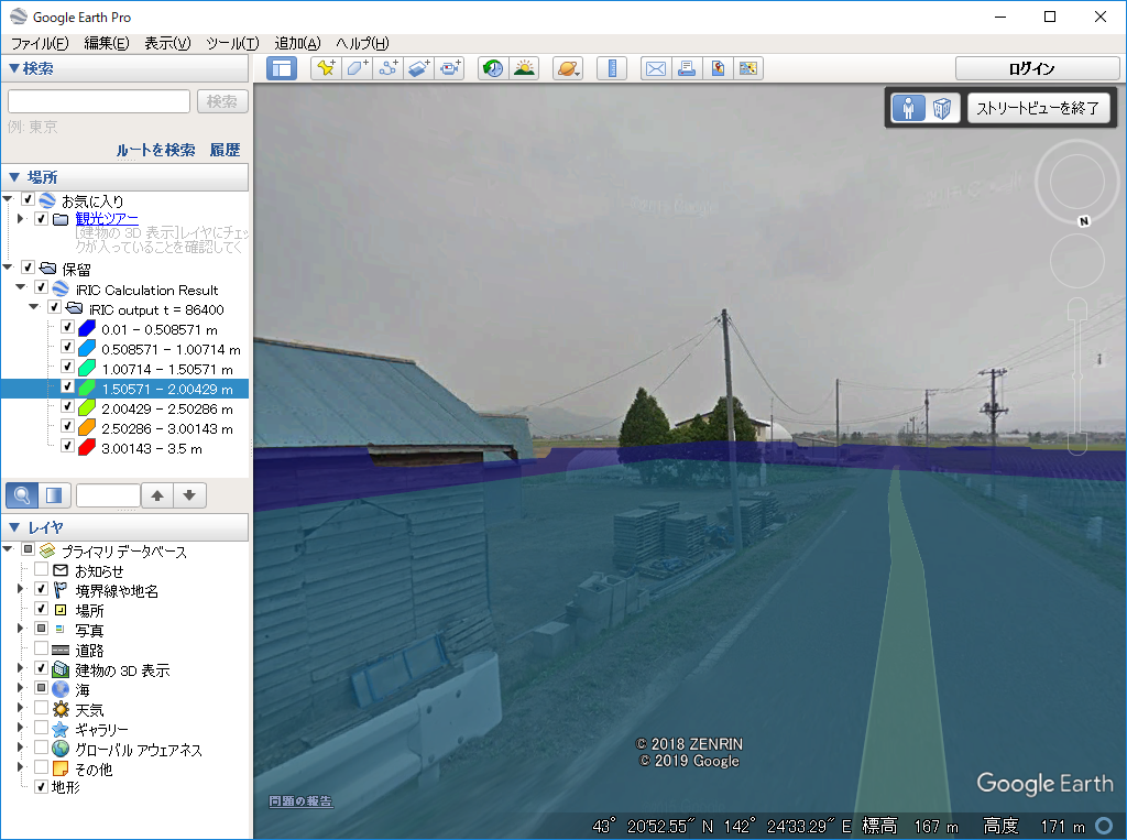
Figure 98 Example of [Google Earth] showing street view after loading a KMZ file