[Property] (P)
Description: Shows the property dialog of the current project. Figure 41 shows an example of the [Project Property] dialog.
You can specify the followings from this dialog.
- Coordinate system
- Offset
- Date for t = 0
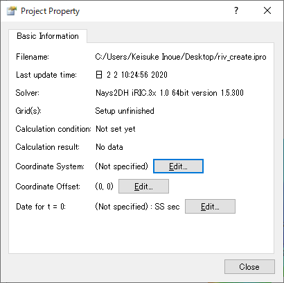
Figure 41 The [Project Property] dialog
[Coordinate System]
When you click on [Edit] button next to [Coordinate System], the dialog in Figure 42 appears, and you can choose the coordinate system for your geographic data and grid.
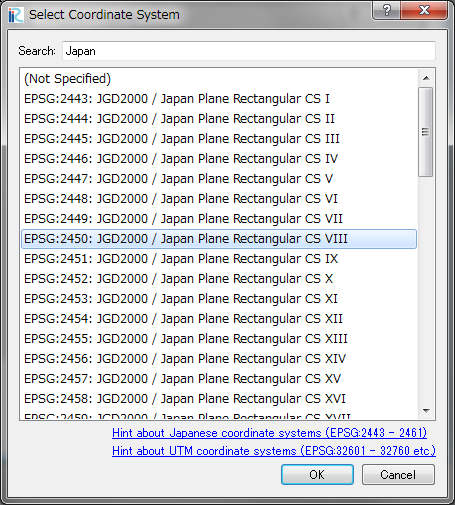
Figure 42 The [Select Coordinate System] dialog
[Offset]
When you click on [Edit] button next to [Coordinate Offset], the dialog in Figure 43 appears, and you can input the offset for the coordinates.
When you want to use geographic data and grids very far from the origin point of the coordinate system (for example, using UTM coordinate System and handles geographic data far from equator), inputting offset will reduce the truncation error. In such cases, please input the x and y for some point near to your geographic data (or grid).
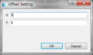
Figure 43 The [Offset Setting] dialog
[Date for t = 0]
When you click on [Edit] button next to [Date for t = 0], the dialog in Figure 44 appears, and you can edit the date for t = 0, and format to show time.
When date for t = 0 and format is specified, the setting is applied to [Animation Toolbar] ([Animation Toolbar]), [2D Post-processing Window] ([2D Post-processing Window]) and [3D Post-processing Window] ([3D Post-processing Window]).
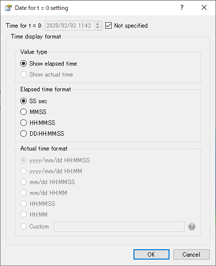
Figure 44 [Date for t = 0 setting] dialog